Neubau (Gemeindebezirk Neubau)
Neubau (Central Bavarian: Neibau) is the seventh district of Vienna (7. Bezirk). It is located near the center of Vienna and was established as a district in 1850, but borders changed later. Neubau is a heavily populated urban area, with a major shopping area and residential buildings. It has a population of 32,027 people (as of 2016-01-01) within an area of 1.61 km² (0.62 sq.mi.).
It consists of the former Vorstädte of Neubau, Altlerchenfeld, St. Ulrich, Schottenfeld and Spittelberg. The district borders are formed by Lerchenfelder Straße in the north, Mariahilfer Straße in the south, Neubaugürtel in the west, and Museumstraße and Museumsplatz in the east.
In the 18th century, Neubau was the location of the city's silk factories. At this time, the area became densely populated. Today, it is an important shopping district, especially in the Mariahilfer Straße and Neubaugasse. Many pubs, popular among the district's large student population, are located in the Spittelberg neighborhood. The Volkstheater Wien, one of Vienna's large mainstream theatres, and the Austrian Ministry of Justice are located in Neubau, as well as the Museumsquartier, a centre dedicated to modern art, housing for example the Leopold Collection.
In the 2001 communal elections, Neubau became the first district in Austria with a Green Party plurality (32.6% of the votes).
In the 2004 European elections the Green Party received 41% of all votes, which is more than Social Democratic Party and Austrian People's Party together.
Like Mariahilf, Neubau is known as one of Vienna's districts with the youngest, most liberal, and urban population.
Map - Neubau (Gemeindebezirk Neubau)
Map
Country - Austria
 |
 |
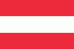
| Flag of Austria | |
Austria emerged from the remnants of the Eastern and Hungarian March at the end of the first millennium. Originally a margraviate of Bavaria, it developed into a duchy of the Holy Roman Empire in 1156 and was later made an archduchy in 1453. In the 16th century, Vienna began serving as the empire's administrative capital and Austria thus became the heartland of the Habsburg monarchy. After the dissolution of the Holy Roman Empire in 1806, Austria established its own empire, which became a great power and the dominant member of the German Confederation. The empire's defeat in the Austro-Prussian War of 1866 led to the end of the Confederation and paved the way for the establishment of Austria-Hungary a year later.
Currency / Language
| ISO | Currency | Symbol | Significant figures |
|---|---|---|---|
| EUR | Euro | € | 2 |
| ISO | Language |
|---|---|
| HR | Croatian language |
| DE | German language |
| HU | Hungarian language |
| SL | Slovene language |


